Arizona Important Bird Areas

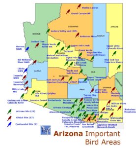
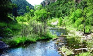
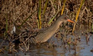
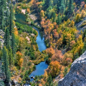
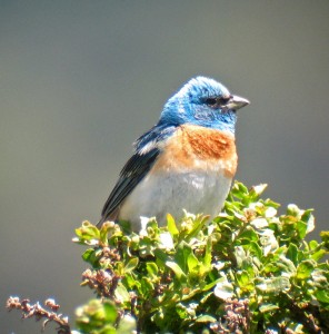
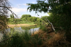
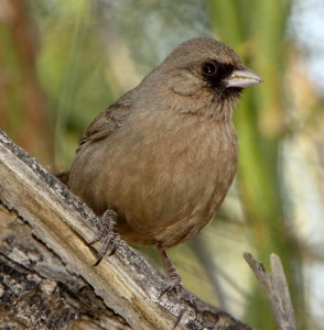
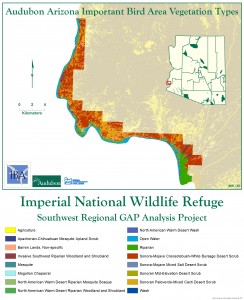
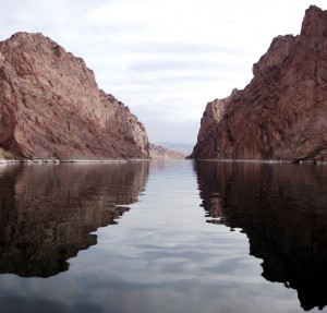
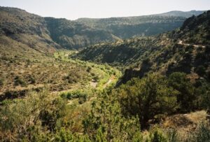
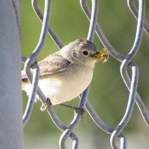
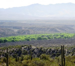
Welcome to Arizona’s 48 Important Bird Areas! These IBAs are varied in the type of habitat they identify yet share the fact that they are vital for Arizona’s native birds. Some are riparian corridors, others cool and lush sky islands. A few are high elevation pine forests and one is even a vast expanse of desert. We hope you enjoy reading about the different IBAs of Arizona and the birds who use them. A map of all of Arizona’s IBAs can be found here.

The IBA designation is non-regulatory; it elevates the profile of an area as being important for birds and acknowledges the stewardship of the landowners and managers.”

☼ = Global Status, ◊ = Continental Status

Interactive zoomable map of all of Arizona’s Important Bird Areas

1. Map of all Arizona IBAs

There are currently 48 Important Bird Areas in Arizona. They range all over the state and cover a wide span of habitat types. If you would like a more interactive tour of Arizona’s Important Bird Areas, there are several options. You can download this KLM file of all of Arizona’s IBAs that can be opened …

Agua Fria National Monument Riparian Corridors IBA

Size: 26.31 square miles, 16843 acresIdentified: 01/2004. Recognized: 01/2010VISITING THE IBA: The Agua Fria National Monument is located 40 miles north of Phoenix, AZ. It is easily accessed by traveling on Interstate 17 to the Badger Springs Exit (Exit #256), Bloody Basin Road Exit (Exit #259) or Cordes Lakes and Dugas exits. SITE DESCRIPTION: Agua …

Anderson Mesa IBA ☼

Global IBA for Pinyon Jay Conservation Stewards: Northern Arizona Audubon Society and Arizona Antelope Foundation Size: 261 square miles, 167509 acres Identified: 01/2004. Global: 10/2009 Visiting the IBA: Located 20 miles southeast of Flagstaff, take the Lake Mary Road exit and travel east on Forest Road 3. Mormon Lake Lodge is located on the south side …

Montezuma Quail by Mark Watson

Appleton-Whittell Research Ranch of the NAS IBA

Size: 12 square miles, 7723 acres 6028°N:  110.5217°W County: Santa Cruz Identified: 01/2004 Criteria: State: Species of Conservation Concern State: Species in rare/unique habitat (Grassland Birds) Visiting the IBA: Visitors are asked to e-mail researchranch@audubon.org or call 520-455-5522 before scheduling a trip. This IBA is located south of the town of Elgin. The miles before the …

arivaca_cienega_MGriffiths

Arivaca Cienega and Creek IBA

Size: 7.7 square miles, 4930 acres Identified: 07/2002 Visiting the IBA: From Tucson take Highway 286 south from Three Points to milepost 12. Turn left and drive east 12 miles to Arivaca. From Interstate 19, take the Amado/Arivaca exit west, turn right at the T, then left at the Cow Palace onto Arivaca Road. Then …

Sycamore Canyon creek by Kendall Kroesen

Atascosa Highlands IBA

Size: 313 square miles, 810 square kilometers Identified: 6/2019, encompassed previously identified California Gulch IBA (7/2002) and Sycamore Canyon IBA (4/2003) Ownership: Coronado National Forest County: Santa Cruz Location: 31.65105374697809, -110.52903541444465 Directions to site: From Tucson: Go south on I-19 to Exit 12 to access Ruby Road. Go west on Ruby Road into the Atascosa Highlands. Ruby Rd is the …

Golden Eagle + Ferruginous Hawk by Kenny Wilkins

Aubrey Valley and Cliffs IBA

Size: 385 square miles, 246,538 acres Identified: 10/2011 Visiting the IBA: Primary access is at Pika Camp gate located north of old Route 66 just before milepost 123. Go through a large gate named Pica Camp and proceed approximately 2.5 miles to a sign in station. Roads are graded, and high clearance vehicles are recommended. …

Ridgway's Rail by Len Blumin

Bill Williams River National Wildlife Refuge IBA ☼ ◊

Global IBA for Bell’s Vireo and Black Rail Continental IBA for Yuma Ridgway’s Rail and Clark’s Grebe Size: 9.4 square miles, 6000 acres Identified: 01/2004. Global: 10/2010. Continental: 10/2011 Visiting the IBA: To get to Bill Williams River NWR from Lake Havasu City, Arizona follow Arizona Highway 95 south approximately 23 miles. Headquarters are located …

Blue and San Francisco Rivers IBA

Identified: 01/2004 Visiting the Site: Located adjacent to the New Mexico border, northeast of Clifton and south of Alpine. For access from the north and Alpine take county route 12 toward Reserve, N.M. and Luna Lake. Turn south on Forest Road 281 into the IBA and to a trailhead into the Blue Primitive Area. The …

Lazuli Bunting by K. Schneider

Boyce Thompson Arboretum and Arnett -Queen Creeks IBA

Size: 4.8 square miles, 3,071 acres Identified: 01/2004. Recognized: 05/2007 Visiting the IBA: From Phoenix: Take Highway 60 east toward Superior until you reach milepost #223. Drive takes about an hour. From Tucson: Take Oracle Road north, turn left at highway 79 and continue through and past Florence to highway 60, then turn right and …

Camp Verde IBA

Size: 6.06 square miles Identified: 6/2019 Visiting the IBA: The publicly accessible areas of the Verde River corridor through the Town of Camp Verde can best be accessed at the following sites: Parsons Park, Homestead Park, Rezzonico Park, White Bridge River Access Point (RAP), Clear Creek River Access Point, Clear Creek Campground Day Use Area, and …

Abert's Towhee by Alan Vernon

Cave Creek Ecosystem IBA

Size: 4.2 square miles, 2,657 acres Identified: 06/2009 Visiting the IBA: Access to the Tonto National Forest, including the Seven Springs Recreation Area and the Cave Creek Trail, is via Seven Springs Road (Forest Road 24) north of Scottsdale. The Spur Cross Ranch Conservation Area and the Jewel of the Creek Preserve are located at …

Chiricahua Mountains IBA ☼

Global IBA for Mexican Spotted Owl Size: 452.5 square miles, 289,600 acres Identified: 04/2003. Global:10/2009 Visiting the IBA: From Sierra Vista go east on Hwy 90 then south on Hwy 80 to Bisbee; continue east on Hwy 80 to Douglas; continue northeast on Hwy 80 to Rodeo, NM; and finally go west on Portal Road …

Cibola National Wildlife Refuge IBA ◊

Continental IBA for Yuma Clapper Rail Size: 22.8 square miles, 14,578 acres Identified: 06/2008 Visiting the IBA: From Blythe, go approximately 3 miles west on I-10 to Neighbours Boulevard/78 exit. Go south on Neighbours for 12 milesto the Cibola Bridge. After crossing the bridge, continue south for 3.5 miles to headquarters. Site Description: Cibola NWR …

Great Egret by Martin Ely

Gilbert Riparian Preserves IBA

Identified: 01/2007 Visiting the IBA: Take US 60 to the Greenfield Road Exit. South on Greenfield and drive south to Guadalupe. The entrance to the parking lot is east of Greenfield on Guadalupe. Winter and spring are the best times to visit. Ownership: Town of Gilbert Site Description: The Gilbert Riparian Preserves IBA contains two …

California condor by Don Graham

Grand Canyon National Park IBA ☼

Global IBA for California Condor and Mexican Spotted Owl Size: 778 square miles, 497,894 acres Identified: 07/2002 Visiting the IBA: To visit the South Rim of the Grand Canyon where Lipan and Yaki Points are located, take I-17 North to Flagstaff, Arizona and then take Highway 89 North to just before Cameron and take State …

Havasu National Wildlife Refuge IBA ◊

Continental IBA for Yuma Clapper Rail Size: 61.4 square miles, 39,281 acres Identified: 06/2008 Visiting the IBA: The refuge office is in Needles, California. From Interstate 40, exit on J Street and go southwest (uphill) 0.6 miles. Turn right at the headquarters entrance sign and follow the signs. The office is in the back. Office …

Wild Turkeyby Alan Schmierer

Huachuca Mountains IBA

Identified: 01/2004 Size: 157.9 square miles, 101,028 acres Site Stewards: Huachucha Audubon Society and Birdland Ranch in Algerita Canyon on the west side and The Nature Conservancy Ramsey Canyon Preserve on the east side. Visiting the IBA: To reach the most popular birding sites in the Huachucas, you must go through Fort Huachuca. Please note that everyone …

Imperial National Wildlife Refuge IBA ☼ ◊

Global IBA for Black Rail and Continental IBA for Yuma Clapper Rail Site Steward: Yuma Audubon Society Size: 49.3 square miles, 31,558 acres Identified: 06/2008 Visiting the IBA: From Yuma: Travel north on Highway 95. Near Milepost 47 turn left onto Martinez Lake Road. Follow Martinez Lake Road west for approximately 10 miles. Turn right …

Imperial Reservoir IBA GIS Map

Imperial Reservoir IBA ☼ ◊

Global IBA for Black Rail and Continental IBA for Yuma Clapper Rail Site Steward: Yuma Audubon Society Size: 5.5 square miles, 3,535 acres Identified: 01/2002 Visiting the IBA: Fisher’s Landing and campground located on the north end of the reservoir and Imperial Dam and Hidden Shores Resort on the south end are places with good …

Joshua Tree IBA ☼

Global IBA for Bendire’s Thrasher Size: 213 square miles, 136450 acres Identified: 04/2012  Global: 10/2014 Visiting the IBA: Located west of Wikieup, Arizona in Mohave County Ownership: Bureau of Land Management, state trust lands, and private. Site Description: This area is essentially unknown to birders and other wildlife viewers but consists of excellent habitat and a unique ecotone. As a …

Lower Colorado River_Alan Stark

Lower Colorado River Gadsden Riparian Area IBA

Identified: 01/2004 Size: 3.7 square miles, 2,398 acres Visiting the IBA: Access is difficult and visiting is best recommended with a local guide. An excellent resource for birding this IBA and the lower Colorado River region is Finding Birds in Yuma County, Arizona by Henry Detwiller. Ownership: Various U.S. and Mexican Agencies and Cocopah Tribe Site …

Lower Oak Creek

Lower Oak Creek IBA

Site Steward: Northern Arizona Audubon Society Size: 5.8 square miles, 3,685 acres Identified: 01/2004 Recognized: 04/2006 Visiting the IBA: Red Rock State Park is immediately south of Sedona. The best way to the park is travel on I-17 to Arizona highway 260 west to Arizona Highway 89A and north to Red Rock Loop Road. Page …

Lucy's Warbler by Don Faulkner

Lower Salt and Gila Rivers Ecosystem ☼ ◊

Global IBA for Yuma Ridgeway’s Rail and Neotropical Cormorant Continental IBA for Abert’s Towhee, Yuma Ridgeway’s Rail and Long-billed Curlew Site Steward: Sonoran Audubon and Audubon Arizona Size: 57.3 square miles, 36,645 acres Identified: 07/2002. Recognized: 03/2008. Global/Continental: 10/2011 Visiting the IBA: Arlington Wildlife area is on the west bank of the Gila River approximately 3-1/2 miles south …

Lower San Pedro through the desert

Lower San Pedro River IBA ☼ ◊

Global IBA for Bell’s Vireo Continental IBA for Abert’s Towhee Conservation Stewards: Tucson Audubon Society, The Nature Conservancy, Cascabel Working Group, Redington and Winkleman NRCDs Size: 51.2 square miles, 32,762 acres Identified: 01/2007, Global on 01/2008. Recognized: 02/2008 Visiting the IBA: Most of the lands in this IBA are privately owned with no public access. …

Marble Canyon IBA GIS Map

Marble Canyon and Vermilion Cliffs IBA ☼

Global IBA for California Condor Site Steward: The Peregrine Fund Size: 159.5 square miles, 102,058 acres Identified: 04/2003, Global 01/2008 Visiting the IBA: Lees Ferry and Navajo Bridge Interpretive Center is located on Highway 89A 45 miles southwest of Page Arizona and 62 miles southeast of the North Rim of Grand Canyon National Park. Lees …

Mittry Lake State Wildlife Area IBA ☼ ◊

Global IBA for Black Rail Continental IBA for Yuma Clapper Rail Site Steward: Yuma Audubon Society Size: 6.2 square miles, 3,984 acres Identified: 07/2002 Visiting the IBA: From Yuma, take Highway 95 north to East Imperial Dam Road, then turn left (west) toward the lake, following WA signs. Ownership: BLM and Bureau of Reclamation, managed …

Mogollon Rim Snowmelt Draws IBA

Size: 112.7 square miles, 72,162 acres Identified: 07/2010 Visiting the IBA: Take Highway 87 North from Payson, AZ. North of Pine, AZ, Forest Road 300 “Rim Road” heads east from the 87 and travels through the IBA. This is a relatively primitive area offering stunning views and many opportunities to pull off and explore the …

Patagonia Mountains IBA

Identified: 5/2014 Size: 28 square miles, 18120 acres. Site Stewards: Patagonia Area Resource Alliance (PARA). Visiting the IBA: From Tucson: Go east on I-10 and take exit 281 to Highway 83. Go 25 miles south on Highway 83 to the junction of Highway 82 and 83 in Sonoita, go left (heading west) and go 12 …

Patagonia-Sonoita Creek TNC Preserve IBA

Site Stewards: The Nature Conservancy and Tucson Audubon Size: 0.6 square miles, 387 acres Identified: 07/2010 Visiting the IBA: Patagonia-Sonoita Creek Preserve is 60 miles southeast of Tucson. Take I-10 east to Highway 83 exit south to Sonoita then turn west onto Highway 82. In Patagonia, turn west on 4th Avenue. Turn south on Pennsylvania, …

Male Olive Warbler by Tony Morris

Pinaleño Mountains IBA

Location: UTM 12S 605570 3618850 County: Graham Site Status: Identified 02/2013 Ownership: Coronado National Forest – Safford Ranger District Area: 212 sq miles, perimeter: 161 miles Criteria: D1: State: Species of Conservation Concern D3: State: Species in rare/unique habitat Site Description: The Pinaleño Mountains are one of the most northern of the Coronado Forest “Sky …

Quigley State Wildlife Area IBA GIS Map

Quigley State Wildlife Area IBA

Location: 32.7167° N: 113.967° W County: Yuma Site Status: Identified 01/2004 Ownership: Arizona Game and Fish Commission Area: 0.96 square miles, 614 acres Criteria: B1 (Potential): Continental: Species of Conservation Concern (Yuma Clapper Rail, Abert’s Towhee) D1: State: Species of Conservation Concern D3: State: Species in rare/unique habitat Site Description: The Quigley Wildlife Management Area …

Salt River by Phillip Capper

Salt and Verde Riparian Ecosystem IBA

Identified: 07/2002   Recognized: 11/2010, Fossil Creek added 6/2019. Counties: Maricopa, Yavapai Site Status: Identified Ownership: Tonto National Forest, Fort McDowell Mohave Apache Community Size: 24.3 square miles, 15,523 acres Criteria: B1(Potential): Continental: Species of Conservation Concern (Lucy’s Warbler, Southwest Willow Flycatcher, Gilded Flicker) D1: State: Species of Conservation Concern (Bald Eagle –SW population) D3: State: …

San Pedro River National Conservation Area IBA GIS Map

San Pedro Riparian National Conservation Area IBA

County: Cochise   Site Status: Identified 07/2002, Global Recognition 05/2013 Ownership: BLM Area: 22,662.4 hectares (56,000 acres approx.) D1: State: Species of Conservation Concern (Yellow- billed Cuckoo, Cassin’s and Botteri’s Sparrow) and migration bottleneck Spring Warblers, Wilson’s and Yellow Warbler; Olive-sided Flycatcher Criteria: A1: Global: Species of Global Conservation Concern (Bell’s Vireo) D3: State: Species …

San Rafael Grasslands IBA GIS Map

San Rafael Grasslands IBA ☼

Location: 534883 N 3480007 E  UTM NAD 27 County: Santa Cruz Site Status: Identified 10/2011 Ownership: Private and State Area: 85 square miles, 56,983 acres Criteria: A1; Global; Species of Conservation Concern – Chestnut Collared Longspur (Wintering) D1 – Site Important to Special Status Avian Species (Chestnut-collared Longspur, Arizona Grasshopper Sparrow, Cassin’s Sparrow, Savannah Sparrow, …

Santa Rita Mountains IBA

Counties: Pima, Santa Cruz Site Status: Identified 04/2003, Recognized 05/2011 Ownership: Coronado National Forest, Area: 217 square miles, 138,760 acres Criteria: B3 (Potential) – Assemblage of individuals/species concentrated in a Bird Conservation Region D1: State: Species of Conservation Concern   Site Description: The Santa Rita Mountains are 35 miles south of Tucson, and span from …

Neotropical Cormorant by Gustavo Duran

Sonoita Creek State Natural Area/Patagonia Lake IBA

Counties: Santa Cruz Site Status: Indentified 01/2007, Recognized 04/2007 Ownership: Arizona State Parks Area: 5.5 square miles, 3,497 acres Criteria:B1 (Potential): Continental: Species of Conservation Concern (Gray Hawk, Yellow-billed Cuckoo, Bell’s Vireo, Northern Beardless-Tyrannulet, Lucy’s Warbler, Abert’s Towhee, Rufous-winged Sparrow, Varied Bunting.) D1: State: Species of Conservation Concern D4iv: State: Waterbirds Grebes & Cormorants  Site …

Costa's Hummingbird by Desert Vu

Sonoran Desert Borderlands IBA

Location: UTM 3545154 N  326281 E  NAD 83 Counties: Pima and Yuma Site Status: Identified 07/2010 Ownership: Federal, USFWS and NPS Area: 1,851 square miles, 1,184,668 acres Criteria: D1 – Site Important to Special Status Avian Species (Gilded Flicker, Bendire’s Thrasher, Le Conte’s Thrasher, Sage Thrasher, Costa’s Hummingbird, Abert’s Towhee, Brewer’s Sparrow, Cactus Ferruginous Pygmy …

Desert Purple Martin by SearchNetMedia

Tanque Verde Wash/Sabino Canyon IBA

Location: 32.2955° N: 110.8079° W County: Pima Site Status: Identified 01/2004, Expanded 10/2011 Ownership:  US Forest Service and Private Area: 7.5 square miles, 4,770 acres Criteria:B1(Potential): Continental: Species of Conservation Concern (Rufous-winged Sparrow; Elf Owl, Abert’s Towhee, Costa’s Hummingbird, Lucy’s Warbler, Gilded Flicker) D1: State: Species of Conservation Concern D3: State: Species in rare/unique habitat …

Tucson Mountains by Derek DeVries

Tucson Mountains IBA

Size: 73.2 square miles, 190.9 square kilometers. Elevation: 2500 to 4688 feet Identified: 3/20/2017 Visiting the IBA: From Tucson: Located west of Tucson and can be easily accessed via Speedway to Kinney or from the northwest via Picture Rocks Rd. Virtually all of this land is open to the public and there are some very …

View from Santa Catalina Mountains into Catalina State Park. Photo by Charles Miles

Tucson Sky Islands IBA

Size: 511 sq miles, 1325 sq kilometers. Elevation: 2803 to 8189 feet. Identified: 3/20/2017 Visiting the IBA: From Tucson: There are several good access points for the public, notably Catalina Highway travels up Mount Lemmon to access the higher elevations of the Santa Catalinas and Cactus Forest Loop Road is excellent access within Saguaro National …

Virginia's Warbler by Jerry Oldenettel

Tuzigoot IBA

Location: Lat: 34.7807°N Long: 112.0284°W County: Yavapai Site Status: Identified 07/2002 Ownership: Arizona State Parks, National Park Service, Coconino National Forest, Private Area: 3.5 square miles, 2,267 acres Criteria: D1: State: Species of Conservation Concern D3: State: Species in rare/unique habitat: Marsh   Site Description: This IBA consists of three distinct and inter-related water-based systems: …

Indigo bunting by Evangelio Gonzalez

Upper Little Colorado River Watershed IBA

Counties: Apache Site Status: Identified 04/2003, Recognized 07/2008 Ownership: Apache-Sitgreaves National Forest, Arizona Game and Fish Department, State Lands, BLM Area: 95.9 square miles, 61,360 acres Criteria: A1: Global (Potential): Species of Conservation Concern (Mexican Spotted Owl) D1: State: Species of Conservation Concern D3: State: Species in rare/unique habitat: Riparian Site Description This IBA encompasses …

Santa Cruz River S. of Tumacacori, 2, 3-05, john hoffman

Upper Santa Cruz River IBA

County: Santa Cruz Site Status: Identified 01/2007, Recognized 04/2011 Ownership: National Park Service and Private Area: 3.4 square miles, 2,184 square miles Criteria: A1 (Potential): Species of Global Conservation Concern (Bell’s Vireo) B1(Potential): Continental: Species of Conservation Concern (Gray Hawk, Yellow-billed Cuckoo, Bell’s Vireo, Northern Beardless-Tyrannulet, Lucy’s Warbler, Abert’s Towhee, Rufous-winged Sparrow, Varied Bunting.) D1: …

Upper Verde River State Wildlife Area IBA

 Location: 3858479N  367626E  UTM NAD83 County: Yavapai Site Status: Identified 06/2008 Ownership: Arizona Game and Fish and State Trust Area: 2.8 square miles, 1,809 acres Criteria: D1 – Site Important to Special Status Avian Species – Yellow-billed Cuckoo, Lucy’s Warbler, Yellow Warbler and others. D4ii – Significant Concentrations of Birds – Landbirds, Riparian bird diversity …

Watson and Willow Lakes Ecosystem IBA

Watson and Willow Lakes Ecosystem IBA

County: Yavapai Site Status: Identified 07/2002 Recognized 04/2011 Ownership: City of Prescott Area: 2.3 square miles, 1,501 acres Criteria: D1 – State Species of Conservation Concern D4ii – Waterfowl Significant Concentration (>2000) D4iii – Wading birds concentration site Site Description: This Important Bird Area (IBA) is located within the city limits of Prescott, AZ at …

Whitewater Draw by Dave Bezaire

Whitewater Draw State Wildlife Area IBA ☼

Location: 349435 N  12 621331 E UTM NAD27 County: Cochise Site Status: Identified 06/2008, Global Identified 10/2011 Ownership: Arizona Game and Fish Area: 2.4 square miles, 1,509 acres Criteria: D1 – Site Important to Special Status Avian Species – Bendire’s Thrasher, Long-billed Curlew, Scaled Quail and Cassin’s Sparrow D4vi – Significant Concentrations of Birds – …

Willcox PlayaCochise Lakes IBA GIS Map

Willcox Playa/Cochise Lakes IBA ☼

 Location: 609284 N 3557623 E UTM NAD27 County: Cochise Site Status: Identified 06/2009, Global Identified 10/2011 Ownership: Federal, State and City of Willcox Area: 74 square miles, 47,343 acres Criteria: D1 – Site Important to Special Status Avian Species – Swainson’s Hawk, Scaled Quail, Chestnut-collared Longspur and Cassin’s Sparrow D4v – Significant Concentrations of Birds …

Maricopa Burrowing Owl Haven

Sites of Conservation Significance

Sites of Conservation Significance The Arizona Important Bird Areas program looks at many areas and considers them for IBA status. While many of the areas we look at are formally proposed to our Science Committee and approved, some sites just don’t meet all the requirements and are not formally proposed. This is usually due to …