Marble Canyon by James Phelps
Global IBA for California Condor
Site Steward: The Peregrine Fund
Size: 159.5 square miles, 102,058 acres
Identified: 04/2003, Global 01/2008
Visiting the IBA: Lees Ferry and Navajo Bridge Interpretive Center is located on Highway 89A 45 miles southwest of Page Arizona and 62 miles southeast of the North Rim of Grand Canyon National Park. Lees Ferry is located seven miles down the Lees Ferry road from Navajo Bridge Interpretive Center. Vermilion Cliffs are located adjacent to U.S. Highway Alternate 89 (89A) for approximately 30 miles to the south and west. From Kanab, Utah, take U.S. Highway Alternate 89 (89A) south and then east from Jacob Lake to the cliffs. Tuba City to Page – Arizona Birding Trail
Ownership: National Park Service Glen Canyon National Recreation Area, Bureau of Land Management
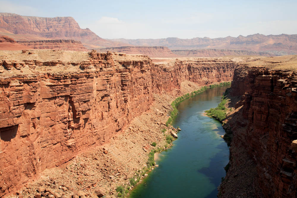
Site Description: This IBA is the Colorado River corridor and adjacent side canyons from Glen Canyon Dam to the mouth of the Little Colorado River and the Vermilion Cliffs Wilderness Area.
Birds: Species of special conservation status and interest that use the habitats within this IBA include:

California Condor by Michael Quinn
Year-round: Great Blue Heron, California Condor, Peregrine Falcon, Prairie Falcon, Golden Eagle, Spotted Owl.
Breeding: Bell’s Vireo, Lucy’s Warbler, Yellow Warbler, Summer Tanager, Bullock’s Oriole, Hooded Oriole.
Migration: Warbling Vireo, Yellow-rumped Warbler (Audubon’s), MacGillivray’s Warbler, Virginia’s Warbler, Black-throated Gray Warbler, Nashville Warbler, and Wilson’s Warbler.
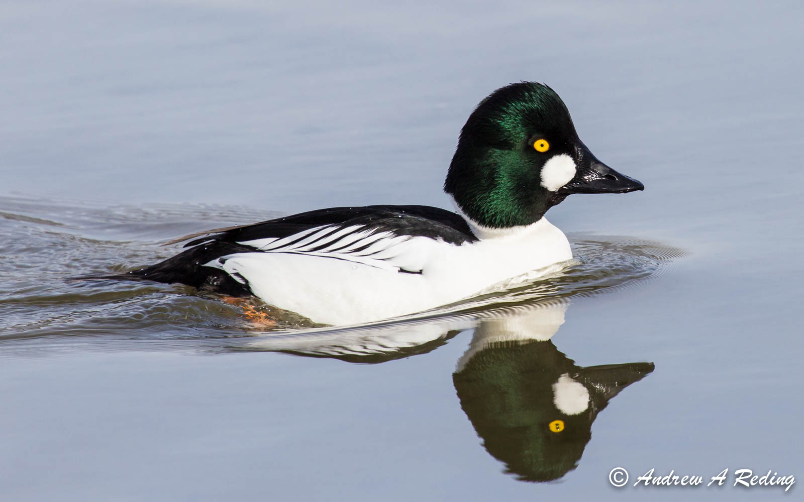
Winter: American Coot, Ring-billed Gull, Western Grebe, Gadwall, Green-winged teal, Common Goldeneye, Redhead, Bald Eagle, Osprey.
Conservation Concerns: Invasive plants (tamarisk and Ravenna grass). Strategy: Tamarisk Leaf-eating Beetle is impacting the tamarisk trees.
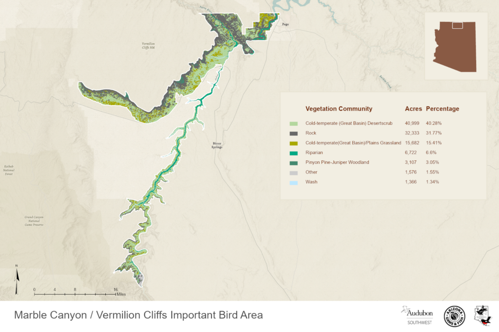
Map of this Important Bird Area:

Marble Canyon IBA GIS Map – zoomed out
Marble Canyon and Vermilion Cliffs | Arizona Wildlife Conservation Strategy
Complete eBird.org Checklist of birds Reported for Marble Canyon and Vermilion Cliffs IBA
For an interactive map and habitat and land ownership analysis of this IBA visit the National Audubon IBA Map and select “Arizona” and then the name of this Important Bird Area. To access analysis graphs, click on the map boundary of the IBA.
Location: 36.8656°N: 111.5848°W
County: Coconino
Site Status: Identified 04/2003, Identified as Global 01/2008
Ownership: National Park Service
Area: 159.5 square miles, 102,058 acres
Criteria: A1: Global: Species of Global Conservation Concern (California Condor)
D1: State: Species of Conservation Concern
Site Description: Total length of the IBA is 125 km. Tracking of California Condors by biologists shows considerable movement throughout the region. In spring and early summer 2004, as in earlier years, the birds frequented the Colorado River corridor along Marble Canyon and thence to the South Rim of the Grand Canyon, delighting Park visitors with splendid appearances and flights near enough for pictures. Details about Condors in Arizona can be found on http://www.peregrinefund.org/
| Vegetation Description | Hectares |
| GREAT BASIN DESERTSCRUB | 98475.27 |
| OTHER | 4780944 |
| PINYON – JUNIPER COMMUNITIES | 177879.6 |
| PLAINS GRASSLAND | 24652.93 |
Ornithological Summary:
| Species or group | Season | Maximum | Year |
| California Condor (Period). Present | Breeding | 2 pair | 2008 |
| Peregrine Falcon | Breeding | 35 individuals (est. 17 pairs) | No date |
| Bald Eagle | Winter | 50 individuals. | No date |
| Lucy’s Warbler | Breeding | 100+ individuals. | 200 |
Common Goldeneye by Andrew Reding
This IBA supports outstanding numbers of over-wintering waterfowl, up to 6000 birds total. The IBA is 20 miles from the release area for the re-introduced population of California Condors in Arizona, and provides a primary foraging and roosting habitat, along with the Grand Canyon National Park further downstream. The Peregrine Fund is the lead organization for the restoration of California Condors at Grand Canyon. By the close of 2005, there were 59 free-ranging condors in the Arizona/Utah population. Reproduction among wild condors in Arizona reached new highs in 2004 and 2005, with two pairs producing young each year. Condors have fledged a chick in each year from Battleship Cliff in the Grand Canyon. Wild fledged condors are using the IBA as a travel and foraging corridor between the Vermilion Cliffs release site and the South Rim of the Grand Canyon. Wild Population of California Condors is currently estimated at 127 individuals and 59 are in Arizona. A Great Blue Heron colony (3-4 pairs) exists within the IBA. The riparian habitat provides the best migration corridor in northern Arizona, and supports substantial numbers of passerines, gulls, raptors (especially Osprey), and Belted Kingfisher.
Conservation Issues: There is a serious threat from exotic invasive plants, particularly tamarisk and Ravenna grass. Other possible threats to birds include disturbance by waterfowl hunters and anglers above Lee’s Ferry and heavy recreational boating occasionally occurring throughout the reach.